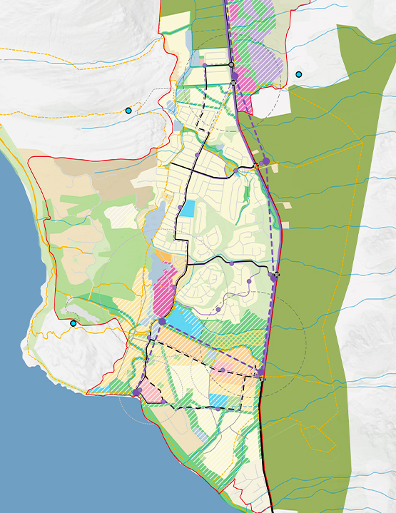
Historically shaped by the Jack’s Point Structure Plan and the Coneburn Area Resource Study (2002), the area has seen progressive development through projects like Jack’s Point, Hanley’s Farm, and Homestead Bay. The recent gifting of 947 hectares of Remarkables Station to the QEII National Trust has further defined the landscape, balancing conservation with development potential.
Te Tapuae Southern Corridor faces a complex set of challenges, including:
- Managing growth within a sensitive landscape surrounded by Outstanding Natural Landscapes and Features;
- Integrating new higher-density greenfield development alongside existing neighbourhoods;
- Addressing infrastructure constraints, particularly transport and wastewater;
- Ensuring resilience to natural hazards such as alluvial fans and liquefaction; and
- Protecting cultural values and ecological systems while enabling urban intensification.
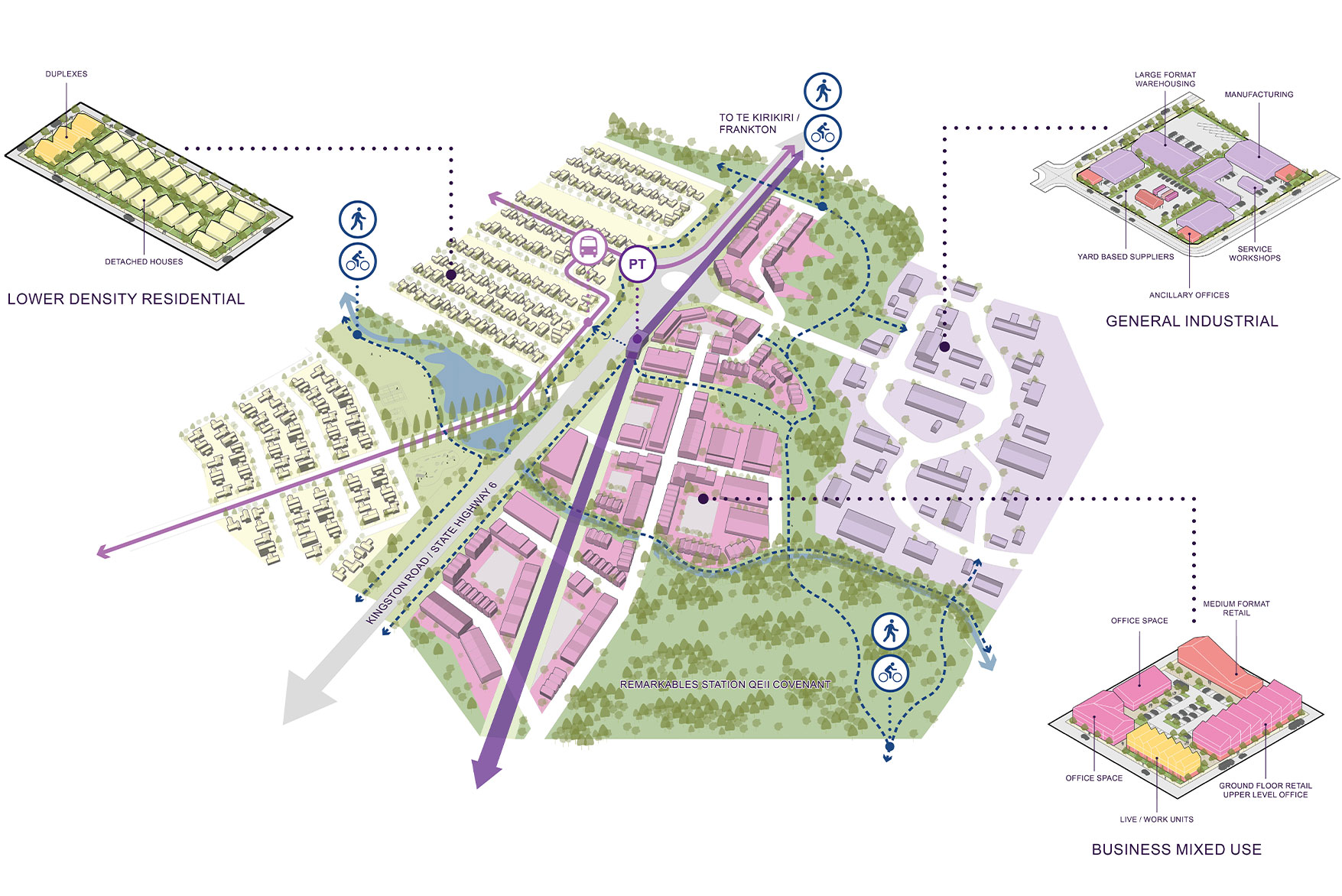
Te Tapuae Southern Corridor Structure Plan seeks to deliver a well-functioning, self-sustaining urban community, enhance blue-green networks and ecological corridors, promote sustainable transport and reduce carbon emissions, while celebrating Kāi Tahu cultural values and restoring wāhi tūpuna.
The Plan aims to enable a resilient, inclusive, and culturally rich community through the delivery of up to 10,000 new dwellings in a range of densities, establish a hierarchy of centres to support local living, and provide for schools, health facilities, and community infrastructure.
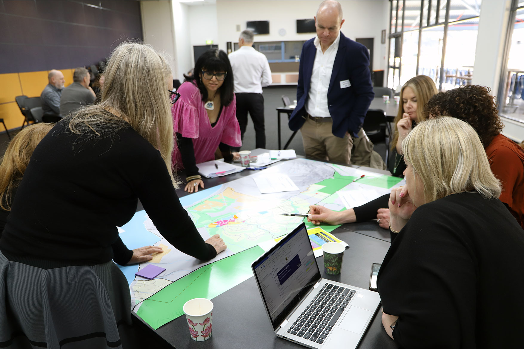
Boffa Miskell led the structure planning process in collaboration with the Grow Well Whaiora Partnership. Our multi-disciplinary role includes urban design and spatial planning, stakeholder and community engagement, and coordination with the wider project team technical experts across transport planning and landscape planning
Te Tapuae Southern Corridor Structure Plan was developed through a staged process, including workshops with partners and developers, community drop-in sessions, and technical assessments. Integration of cultural, ecological, infrastructure, and transport considerations, and development of longlist and shortlist structure plan options will inform future District Plan variations and infrastructure investment decisions.
Te Tapuae Southern Corridor is currently accessed via State Highway 6, which is nearing capacity. The structure plan proposes:
- A frequent public transport corridor with potential for mass rapid transit (MRT) and ferry services.
- Active travel networks including walking and cycling trails.
- Park and Ride facilities to support mode shift.
- Integrated land use and transport planning to reduce reliance on private vehicles.
Sustainability is embedded throughout the plan, with a focus on compact, mixed-use centres, energy-efficient housing typologies, and infrastructure resilience. The plan supports Queenstown Lakes District Council’s zero-carbon goals and climate adaptation strategies.
The structure plan is deeply informed by Kāi Tahu values, including Whanaungatanga (community and family connection), Haere whakamua (future-focused development), and Mauri (life force of land and water).
It recognises the cultural significance of Tititea Wāhi Tūpuna and aims to restore the mauri of water through nature-based stormwater solutions that give effect to Te Mana o te Wai. The plan also supports Kāi Tahu aspirations for visibility, intergenerational resilience, and economic participation.
Ecologically, the plan enhances biodiversity through endemic planting, riparian restoration, and the creation of green corridors linking the Remarkables to Lake Whakatipu. The QEII-managed Remarkables Station plays a key role in landscape protection and community access.
QLDC will now begin preparation for changes to land use rules in the area to enable its implementation. This will likely result in one or a mixture of variations and/or plan changes as part of the District Plan.