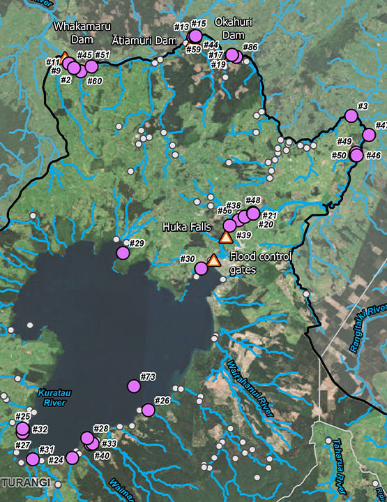
Freshwater systems in the central North Island are ecologically and culturally significant; however, the distribution and spread pathways of pest fish were unclear at a regional scale. To address this, we used a multi‑layered approach combining:
- Desktop GIS mapping and spatial analysis
- Interrogation of the New Zealand Freshwater Fish Database
- Review of eDNA datasets and historic species records
- Hydrological and river‑gradient modelling
- River environment classification layers
- Expert knowledge from DOC freshwater specialists and regional councils
This integrated analysis allowed us to delineate known populations and infer likely upstream invasion risks across large, interconnected hydrological networks.
Hydrological connectivity modelling, barrier assessments, and catchment‑scale spatial analysis were used to map potential dispersal pathways. These outputs enable DOC to identify where eradication or containment is feasible, prioritise surveillance, understand high‑risk invasion routes, and allocate resources more effectively.
Recommendations were structured using the Fish Risk Assessment Model (FRAM) to incorporate ecological vulnerability and management feasibility.
Originally scoped as a distribution exercise, the project expanded to include feasibility considerations, species‑specific prioritisation, and assessment of ecological and cultural implications across catchments. The final outputs provide DOC with:
- The most up‑to‑date assessment of pest fish distributions in the central North Island
- A clear hierarchy of management priorities
- Identification of both eradication and containment opportunities
- Guidance for future monitoring and mana whenua engagement
By consolidating multiple datasets, addressing information gaps, and modelling dispersal risk at a catchment scale, we delivered a robust evidence base for investment, surveillance, and engagement with mana whenua and regional councils.